Grasshopper Plugin Development
Current work focuses on translating key components of the Dynamic Lands Lab analysis pipeline into C#-based Grasshopper components. This effort moves core processing logic from script-based workflows into compiled plugins to improve performance, maintainability, and reliability. By integrating these tools directly into the Rhino and Grasshopper ecosystems, the goal is to make the analytical capabilities of the project more accessible to designers and enable broader adoption within computational design workflows.
In-Progress Components
Read preprocessed data from the DLL pipeline into your Grasshopper workflow
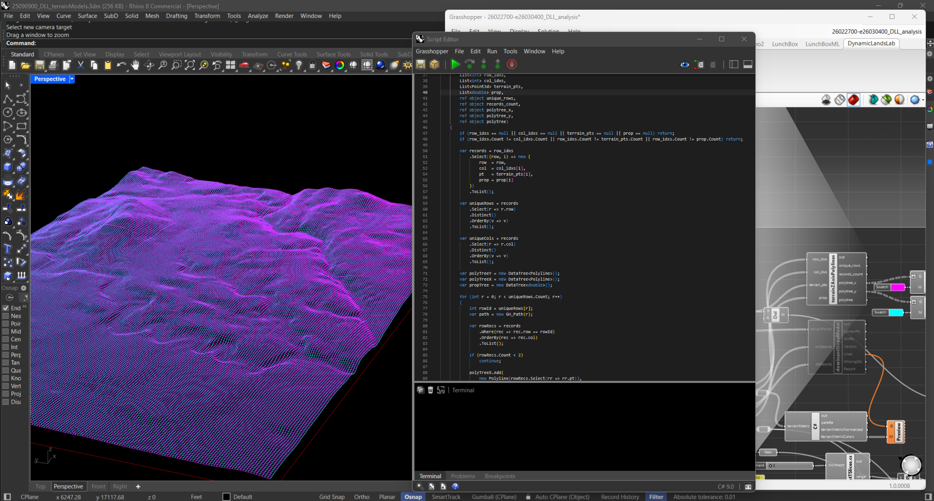
Transform terrain point clouds to wireframe mesh
Construct dominant slope directional models
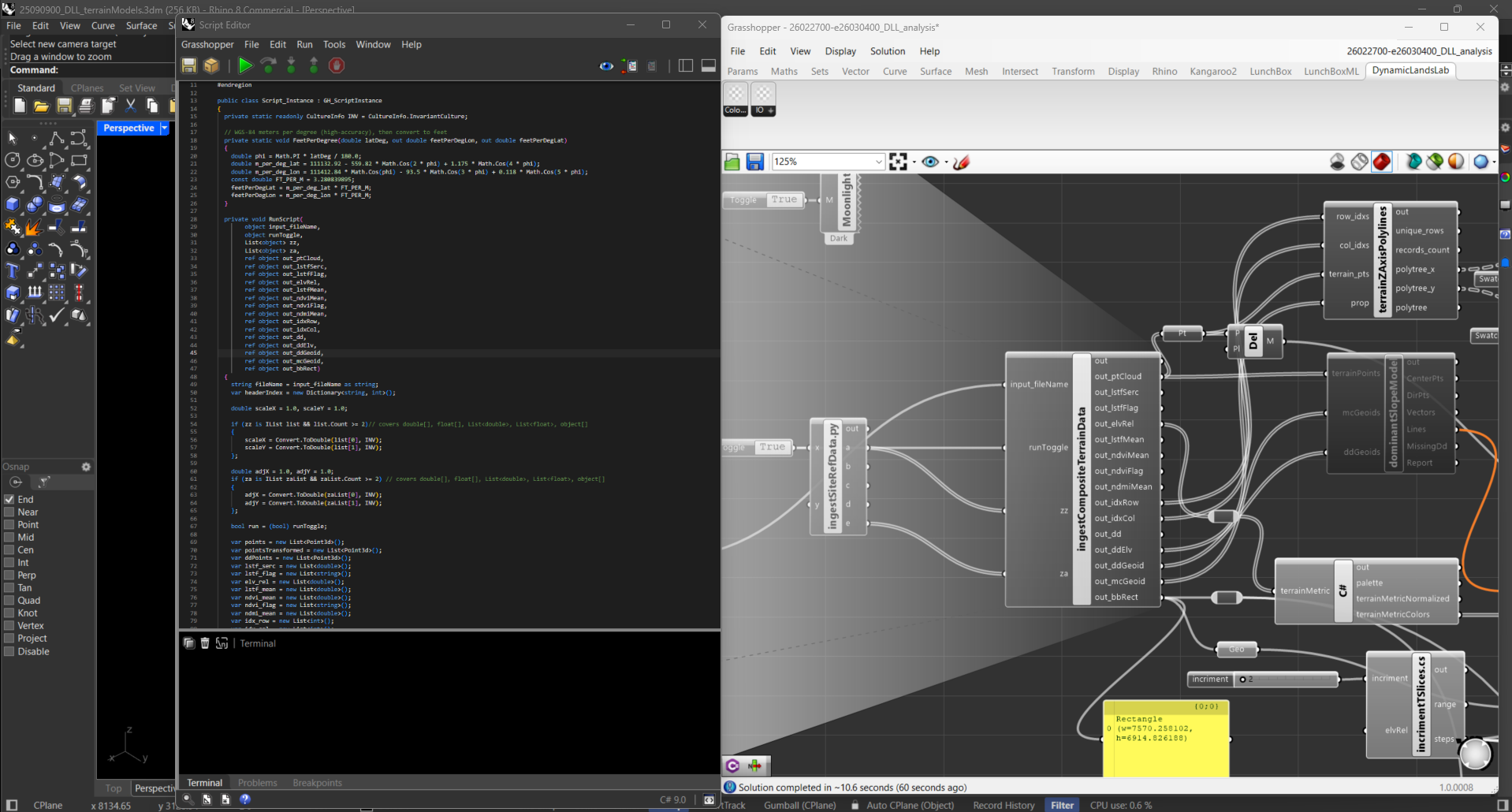
This component reads preprocessed data after it is exported from the DLL pipeline, parses data and transforms points to align with Rhino’s model coordinate system. The component outputs a CRS rectified point cloud and key terrain metrics.
Row and column indices are retained from the initial raster structure and are used to group points by column and row. Grouped points are sorted from east to west and north to south and joined into polylines.
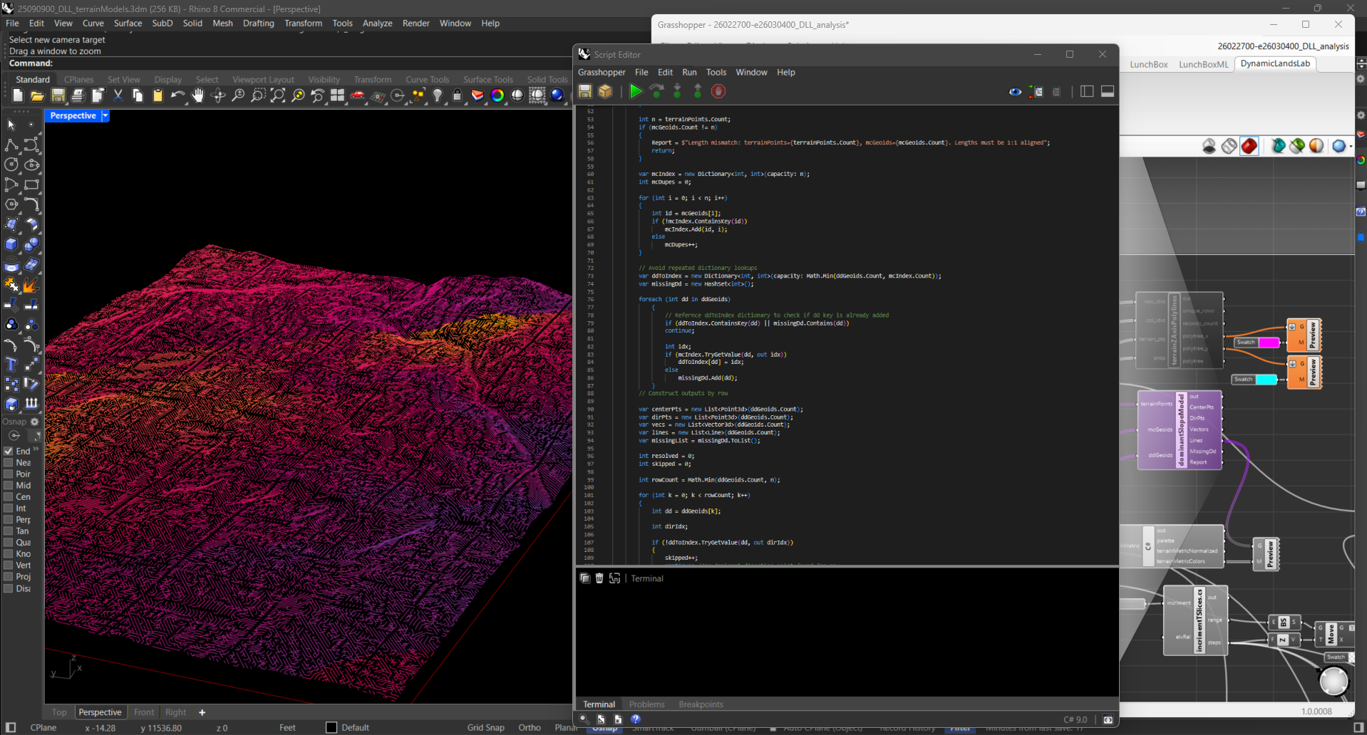
The DLL pipeline computes the dominant local slope direction for each terrain point’s neighborhood group. Retaining directional signals provides keys insights and for use in terrain simulation models such as hydrology and erosion. This component ingests terrain dominant slope directional signals and constructs a 3D directional representation.